Abstract
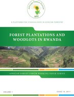
Rwanda is a small, landlocked country in Central Eastern Africa. It is located between latitudes 104' and 2051' South and longitudes 28045' and 31015' East. The territory of Rwanda covers a surface area of 26 338 km2. It borders four countries, viz. the Democratic Republic of Congo (DRC), Burundi, Uganda and Tanzania (Figure 1). The population was estimated at 10.1 million people in 2009 (NISR, 2010) and, therefore, the average population density is 384 people per km2, which is one of the highest in the world. The physiological density (people per area of arable land) is even higher, well in excess of 500 people per km2 (UNDP and UNEP, 2006).
Publication Downloads
🌐 Bilingual Edition · English & French AvailableAccess and download the official document in available languages.
Related Publications & Research
Studies, briefs, and reports matching this subject area, author network, and publication focus.